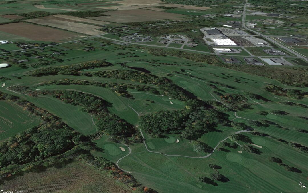
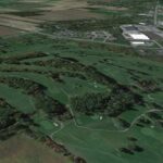
Livingston Country Club’s captivating landscape features not only lush fairways and manicured greens but also intriguing elevation changes that add another dimension to your golfing experience. With comprehensive elevation data for each hole, including specific elevation points for the tee box, 150-yard marker, 100-yard marker, and green, we can now provide a highly precise guide to help you navigate our course effectively and optimize your performance.
Understanding how these elevation changes affect your shot distances and trajectory is essential for conquering LCC’s unique terrain. This guide delves into the physics behind elevation’s influence on golf ball flight, equipping you with the knowledge to strategize your shots and make the most of every lie.
The Science of Elevation and Golf Ball Flight
Elevation changes primarily influence shot distance through their impact on:
- Gravity: When hitting uphill, gravity acts against the ball, reducing its carry distance and leading to a steeper landing angle. Conversely, hitting downhill reduces the effect of gravity, increasing carry distance and resulting in a shallower landing angle.
- Launch Angle: Hitting uphill naturally increases the launch angle, which can lead to a higher ball flight and shorter carry if not adjusted for. Downhill shots tend to have a lower launch angle, potentially reducing carry distance if not compensated for.
Quantifying Elevation Effects
The impact of elevation on distance varies depending on the severity of the slope. Here’s a general guideline for estimating distance adjustments:
| Elevation Change | Distance Change (yards per 100 yards) |
| Uphill 10 feet | -2 to -4 |
| Uphill 20 feet | -4 to -8 |
| Uphill 30 feet | -6 to -12 |
| Downhill 10 feet | +2 to +4 |
| Downhill 20 feet | +4 to +8 |
| Downhill 30 feet | +6 to +12 |
Note: These are approximate values. Actual distance adjustments may vary depending on factors such as ball type, clubhead speed, and shot trajectory.
Tee-to-Green Elevation Changes
| Hole | Tee Elevation (feet) | Green Elevation (feet) | Net Elevation Change (Tee to Green) (feet) | Estimated Distance Change (yards) |
| 1 | 975 | 965 | -10 | -2 to -4 |
| 2 | 969 | 975 | +6 | +1 to +2 |
| 3 | 973 | 994 | +21 | +4 to +8 |
| 4 | 1021 | 969 | -52 | -10 to -20 |
| 5 | 948 | 981 | +33 | +6 to +12 |
| 6 | 974 | 942 | -32 | -6 to -12 |
| 7 | 954 | 965 | +11 | +2 to +4 |
| 8 | 964 | 972 | +8 | +1 to +2 |
| 9 | 962 | 970 | +8 | +1 to +2 |
| 10 | 973 | 977 | +4 | +1 to +2 |
| 11 | 973 | 966 | -7 | -1 to -2 |
| 12 | 967 | 1011 | +44 | +8 to +16 |
| 13 | 985 | 966 | -19 | -4 to -8 |
| 14 | 979 | 1015 | +36 | +7 to +14 |
| 15 | 1014 | 974 | -40 | -8 to -16 |
| 16 | 979 | 981 | +2 | 0 to +1 |
| 17 | 976 | 970 | -6 | -1 to -2 |
| 18 | 975 | 975 | 0 | 0 |
150-Yard Approach Elevation Changes
| Hole | 150-yard Elevation (feet) | Green Elevation (feet) | Net Elevation Change (150 to Green) (feet) | Estimated Distance Change (yards) |
| 1 | 976 | 965 | -11 | -2 to -4 |
| 3 | 979 | 994 | +15 | +3 to +6 |
| 4 | 981 | 969 | -12 | -2 to -4 |
| 5 | 971 | 981 | +10 | +2 to +4 |
| 6 | 940 | 942 | +2 | 0 to +1 |
| 7 | 953 | 965 | +12 | +2 to +4 |
| 8 | 958 | 972 | +14 | +3 to +6 |
| 10 | 978 | 977 | -1 | 0 to -1 |
| 12 | 990 | 1011 | +21 | +4 to +8 |
| 14 | 1007 | 1015 | +8 | +2 to +4 |
| 15 | 990 | 974 | -16 | -3 to -6 |
| 16 | 980 | 981 | +1 | 0 to +1 |
| 17 | 978 | 970 | -8 | -2 to -4 |
100-Yard Approach Elevation Changes
| Hole | 100-yard Elevation (feet) | Green Elevation (feet) | Net Elevation Change (100 to Green) (feet) | Estimated Distance Change (yards) |
| 1 | 980 | 965 | -15 | -3 to -6 |
| 2 | 964 | 975 | +11 | +2 to +4 |
| 3 | 982 | 994 | +12 | +2 to +4 |
| 4 | 979 | 969 | -10 | -2 to -4 |
| 5 | 976 | 981 | +5 | +1 to +2 |
| 6 | 926 | 942 | +16 | +3 to +6 |
| 7 | 961 | 965 | +4 | +1 to +2 |
| 8 | 964 | 972 | +8 | +2 to +4 |
| 9 | 969 | 970 | +1 | 0 to +1 |
| 10 | 983 | 977 | -6 | -1 to -2 |
| 12 | 1000 | 1011 | +11 | +2 to +4 |
| 14 | 1009 | 1015 | +6 | +1 to +2 |
| 15 | 981 | 974 | -7 | -1 to -2 |
| 16 | 980 | 981 | +1 | 0 to +1 |
| 17 | 978 | 970 | -8 | -2 to -4 |
Note: These are approximate values based on the general guidelines for elevation adjustments. Actual distance changes may vary depending on factors such as ball type, clubhead speed, and shot trajectory.
Strategic Application at LCC
- Club Selection: Use the elevation data to inform your club selection for all shots. For uphill holes, consider clubbing up to compensate for the reduced distance. On downhill holes, you may be able to club down.
- Trajectory Control: Adjust your swing to control trajectory based on the elevation change. Uphill, focus on a controlled swing to avoid excessive height. Downhill, consider a slightly steeper swing to maximize carry.
- Landing Spot: Visualize your landing area, taking into account the steeper landing angle on uphill shots and the increased roll-out on downhill shots.
- Course Management: Plan your shots strategically to utilize elevation changes to your advantage. For example, use a downhill slope to gain extra distance or an uphill lie to create a softer landing.
Mastering Elevation at LCC
Livingston Country Club’s diverse terrain, with its unique elevation changes on each hole, provides a captivating challenge. By understanding the scientific principles at play and utilizing the comprehensive elevation data provided, you can confidently navigate our course and optimize your performance on every shot.
Visit our website at livingstoncc.com to book your tee time and experience the strategic intricacies of playing on Livingston Country Club’s dynamic landscape. We look forward to welcoming you to LCC!


Recent Comments